- What green design principles should be used to reduce air pollution?
- Where and how far do people in the city (need to) go for recreation?
- Where are the infrastructural bottlenecks in food transport?
- Where can we densify buildings without compromising liveability?
Description
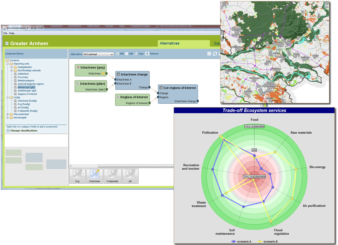
QUICKScan is a method, process and spatially explicit tool that jointly scopes land-use planning issues in a participatory setting. QUICKScan uses strongly moderated participatory workshops, bringing together a wide range of stakeholders relevant to the planning issue at stake. The QUICKScan tool encompasses a modelling environment with functionalities to assess societal- and environmental conditions, diagnose patterns and interactions, implement alternative responses and evaluate the impacts of those responses. It enables analyses of causes; the user can dynamically and interactively adapt the strategies to reach a desired state.
When would I choose this tool?
- To converge ideas and jointly set agendas.
- Regional differences matter and spatial data is available.
- Fast exploration of options and impacts is a key priority.
What are the main advantages?
- The method speeds up policy processes, such as gaining understanding, finding evidence, identifying data and knowledge gaps, and the rapid evaluation of strategies in carrying out impact assessments.
- The method stimulates real interdisciplinary work. Each individual responds to the visualisations of modelled results, which is then discussed by the group.
- The method makes it possible to carry out an assessment without complex, time-consuming and expensive modelling.
How do I apply?
- Hire an experienced team to facilitate and organise a participatory workshop (see contact).
- Get a training (see contact).
- Download the free ‘community’-edition with manual from the web (see further reading).