- Where do we expect urban expansion?
- What are the most suitable locations for growing agricultural crops?
- Where will deforestation take place?
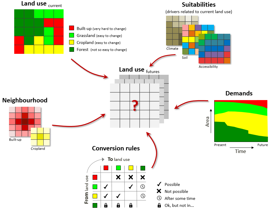
The iCLUE simulation model allocates land use based on areal land use demands. Allocation takes place based on: (1) land use suitability (e.g. no agriculture on steep slopes with dry unfertile soils), (2) conversion rules (e.g. ‘urban cannot change into pasture’, or ‘new production forest can only be harvested after 20 years and turned into fallow land’), (3) neighbouring land use (e.g. built-up area is likely to expand next to existing built-up area) and (4) the areal demand for specific land use types (e.g. 250 hectares of agriculture in my study area in 2030).
Human use of land increasingly alters the structure and the functioning of the environment. To ex-ante understand and anticipate these changes there is an increased need for readily available and operational land use change models. iCLUE provides these essential insights.
iCLUE is an open and transparent system accompanied by a user interface for parametrisation and result visualisation. It calculates fast, allowing for multiple iterations in a single session.
iCLUE is a spatial model that requires spatial data of your study area. Each dataset needs to be prepared in a standardized format (equal spatial extent and cell size). iCLUE is available as part of the QUICKScan environment.