- Which plant traits do vegetation types and crops have in a specific region?
- How are the plant (crops) developing?
- What changes in vegetation are taking place on a short term under influence of management or a lack of management or natural events?
- How should farmers adapt their within field management practices (task maps for precision farming)?
- How many animals do we encounter in a region?
Drones are unmanned airborne vehicles (UAVs) that are able to collect spatial information by flying over a specific area. The spatial information obtained is determined by the type of camera, which can be multi-spectral, hyperspectral, thermal or 3D Laser scanning. This implies that within a very short period of time very detailed spatial information can be collected, which can be easily used to answer questions of the end-users as the examples above.
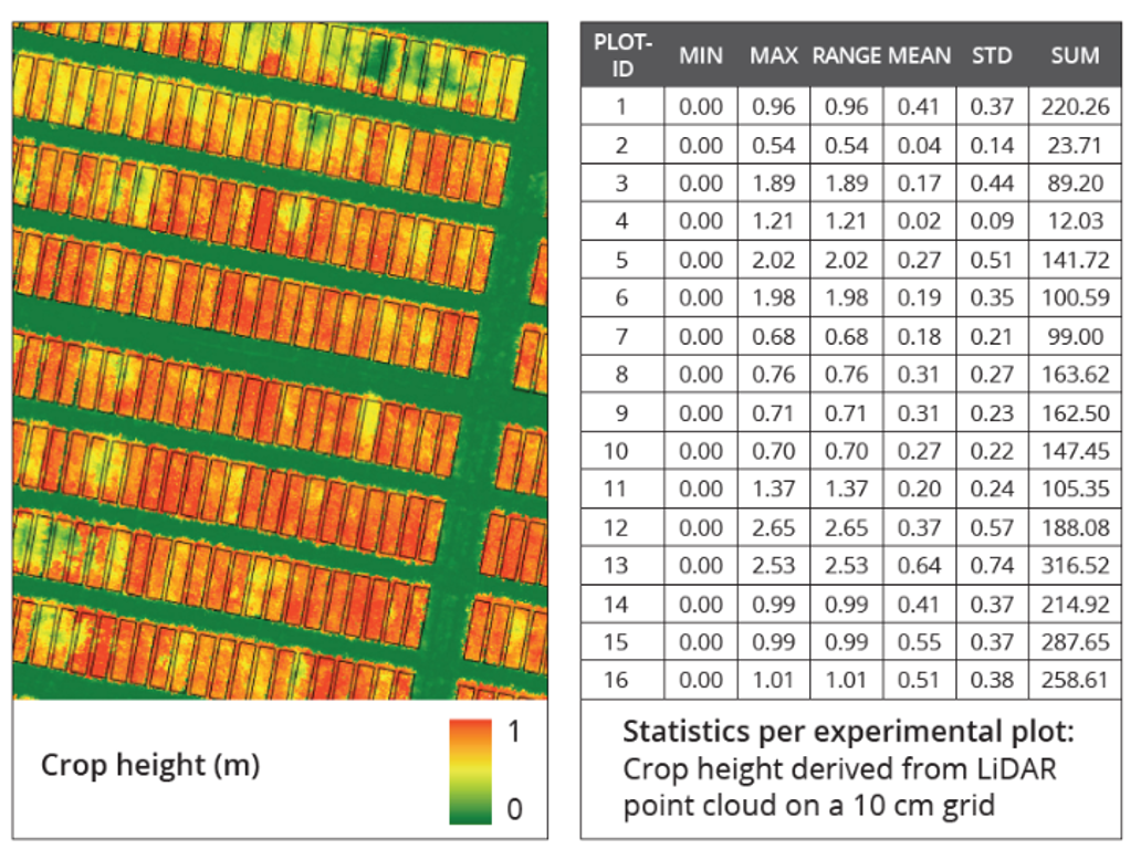
The drones can collect information with a few centimetre resolution which enables us to characterize individual objects, like all single plants or trees. The large amount of information can then be processed by computers into indicators at the field or landscape level that are useful for the end-user.
You only do this when you need information at a centimetre to decimetre resolution that cannot be obtained from satellites. So it mostly concerns detailed and up-to-date information for a relatively small area, like an agriculture field or nature area or forest. Information can obtained for plant biomass, height, chlorophyll content etc.
Next to the very high resolution, you can fly on the most ideal time of the day and with a high time frequency. No cloud constraints as is the case for satellites. It also enables the collection of unique information according to the required standards, e.g. confidential information for plant breeders.